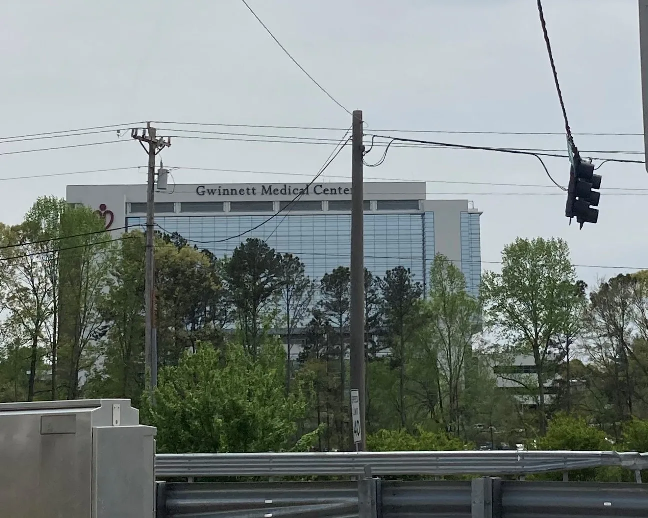
The district around Northside Hospital Gwinnett on Duluth Highway: 496 addresses, most of them apartments, all zoned for Central Gwinnett High.
Last checked Oct. 6, 2026. Sources: the City of Lawrenceville’s 2045 Comprehensive Plan (PDF) and its character area map service, Gwinnett County’s address point and school zone map data, the state’s 2025 School Grades data, Zillow Research, Ride Gwinnett and OpenStreetMap.
West of downtown, Duluth Highway runs past the city’s hospital district: Northside Hospital Gwinnett on Medical Center Boulevard, the Gwinnett Professional Center on Professional Drive, and apartment communities around them. The city’s 2045 Comprehensive Plan maps it as the Medical Services Cluster character area and sets a goal to “grow the medical services cluster surrounding Northside Hospital Gwinnett.”
What this means for you
- Zoned high school: Central Gwinnett High, for every address. Check yours with Find My School.
- Home value: $340,279 in ZIP 30046 in August 2026, according to the Zillow Home Value Index.
- Nearest Ga. 316 interchange: Duluth Highway, about half a mile from the middle of the area in a straight line.
Part of our Lawrenceville neighborhoods guide.
Where it is
This area is the Medical Services Cluster on the city’s own character area map: the land along Duluth Highway (Ga. 120) between Ga. 316 and West Pike Street, around the hospital campus at 1000 Medical Center Blvd. North Lawrenceville, with its own page, is to the east, and the Old Norcross Road area to the south.
Gwinnett County’s address data has 496 addresses here, all in ZIP code 30046. 78% (389) are apartment units; the rest are single buildings and parcels. Inside city limits the city provides police and trash pickup; Gwinnett County provides fire and EMS.
The plan describes Northside Hospital Gwinnett as a 388-bed Level II trauma center with a 24-hour emergency department, and says the Georgia Department of Community Health approved adding seven stories to a 10-story building under construction, for a 17-story facility, in December 2022. The plan lists the expansion among the city’s recent Developments of Regional Impact.
Its transportation work list includes GDOT improvements to Duluth Highway from Ga. 316 to Medical Center Boulevard, and a $14 million bridge widening and $5 million in interchange improvements where Duluth Highway crosses Ga. 316, with no funding source or date named yet.
Schools
Every address in this area is zoned for the same three schools in Gwinnett County Public Schools’ zone map, matched address by address on Oct. 6. Scores are 2025 College and Career Ready Performance Index (CCRPI) figures from the state’s School Grades report; the state average was 78.0 and the district’s 81.5.
| Level | School | Share of addresses | 2025 CCRPI |
|---|---|---|---|
| High | Central Gwinnett High (report card) | 100% | 67.5 |
| Middle | Moore Middle (report card) | 100% | 70.0 |
| Elementary | Lawrenceville Elementary (report card) | 100% | 77.5 |
More in our Lawrenceville schools guide.
Home values
The typical home value in ZIP 30046 was $340,279 in August 2026, down 2.85% from $350,276 in August 2025, according to the Zillow Home Value Index. The index is a modeled typical value for the middle third of homes, not a sale price, and covers the whole ZIP code, including homes outside city limits; it says little about rents in this area’s apartments. The citywide Lawrenceville figure was $376,674, down 2.55% on the year. More in our home prices guide.
Parks and trails
There is no public park inside this area. Downtown’s Lawrenceville Lawn, at Jackson and Luckie streets, and Rhodes Jordan Park, 100 E. Crogan St., with its 1.9-mile paved trail, are the nearest; see our parks guide and walking and biking trails guide.
Getting around
- Ga. 316: the Duluth Highway interchange is at the area’s north end. I-85 is reached at Exit 106 by Ga. 316 west.
- City Hall: about 2.4 miles by road from the middle of the area.
- Airport: about 39.5 miles to Hartsfield-Jackson Atlanta International Airport. Both are distances measured on the OpenStreetMap road network with the OSRM routing engine, not drive times.
- Bus: Ride Gwinnett Route 40 has eight stops here, on Professional Drive and Philip Boulevard, on its way between downtown Lawrenceville, Gwinnett Transit Center and Sugarloaf Mills, according to Ride Gwinnett’s schedule data.
More in our getting around guide.
Groceries and everyday stores
From OpenStreetMap:
- CVS Pharmacy, 620 W. Pike St.
- Publix, 911 Duluth Highway, and ALDI, 996 Duluth Highway, just west of the city line
- Kroger, 2100 Riverside Parkway, just west of the city line
How we drew this area
This area is the Medical Services Cluster character area in the city’s 2045 Comprehensive Plan, taken from the city’s own character area map. School shares come from every address point inside it in Gwinnett County’s address data, matched to the county’s school zone layer on Oct. 6, 2026. Store locations are © OpenStreetMap contributors.
Frequently asked questions
Is the area around Northside Hospital Gwinnett a good place to live?
Here are the facts. It is the city’s Medical Services Cluster along Duluth Highway, with 496 addresses, 78% of them apartment units. Every address is zoned for Central Gwinnett High, which scored 67.5 on the state’s 2025 CCRPI, and Zillow put the typical home value in ZIP 30046 at $340,279 in August 2026.
What schools serve the Northside Hospital Gwinnett area?
Every address in this area is zoned for Lawrenceville Elementary, Moore Middle and Central Gwinnett High in Gwinnett County Public Schools’ zone map.
Where is Northside Hospital Gwinnett?
At 1000 Medical Center Blvd., inside Lawrenceville city limits, off Duluth Highway near Ga. 316. The city’s plan describes it as a 388-bed Level II trauma center with a 24-hour emergency department.
Does a bus go to Northside Hospital Gwinnett?
Ride Gwinnett Route 40 has eight stops in this area, on Professional Drive and Philip Boulevard, according to Ride Gwinnett’s schedule data.
Have your say