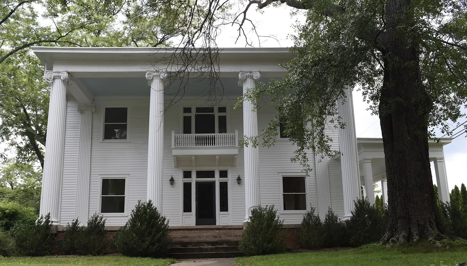
Lawrenceville's eight areas from the city's 2045 plan: ZIP codes, zoned schools and home values. 96% of city addresses are zoned for Central Gwinnett High.
Last checked Oct. 6, 2026. Sources: the City of Lawrenceville’s 2045 Comprehensive Plan (PDF) and its character area map service, Gwinnett County’s address point, city limits and school zone map data, Gwinnett County Public Schools’ Find My School tool, the state’s 2025 School Grades data, Zillow Research, the Census Bureau and OpenStreetMap.
Lawrenceville is the county seat of Gwinnett County, a city of 30,954 people by the Census Bureau’s 2020-2024 American Community Survey five-year estimates. Its layout is simple: the state highways meet at the courthouse square and run out like spokes. Buford Drive (Ga. 20) goes north, East Crogan Street (U.S. 29) east, Grayson Highway (Ga. 20) southeast, Scenic Highway (Ga. 124) south, Lawrenceville Highway (U.S. 29 and Ga. 8) southwest and Duluth Highway (Ga. 120) west. Ga. 316, University Parkway, crosses the north side. There is no interstate in the city; I-85 is reached at Exit 106 by Ga. 316 west.
Three things to know before you look at a listing:
- A Lawrenceville address is often not in Lawrenceville. Gwinnett County’s address data lists 108,950 addresses with Lawrenceville as their city name, but only 14,152 are inside city limits. Inside, the city provides police and trash pickup and sends its own property tax bill; outside, Gwinnett County police patrol and the county’s trash program applies. Check a parcel on the Tax Commissioner’s property search.
- One main ZIP code. In the city, 95% of addresses are in 30046. The rest are in 30043 (378 addresses), 30045 (230) and 30044 (152).
- School zones do not follow city limits, though here they nearly do. In Gwinnett County Public Schools’ zone map, 96% of city addresses are zoned for Central Gwinnett High; the rest are split among Collins Hill (348 addresses), Discovery (178), Mountain View (30), Grayson (23) and Brookwood (21). Always check one address with Find My School.
The areas at a glance
Shares are of each area’s addresses in Gwinnett County’s address data, matched to the district’s zone map on Oct. 6. Home values are the Zillow Home Value Index for August 2026: a modeled typical value for the middle third of homes in the whole ZIP code, not a sale price. The citywide figure was $376,674.
| Area | Addresses | Main ZIP code | Zoned high school | Typical value, main ZIP |
|---|---|---|---|---|
| Downtown | 3,594 | 30046 | Central Gwinnett | $340,279 |
| Buford Drive and Hurricane Shoals Road | 1,733 | 30046 and 30043 | Central Gwinnett (80%), Collins Hill (20%) | $340,279 (30046) |
| Northside Hospital area | 496 | 30046 | Central Gwinnett | $340,279 |
| Old Norcross Road | 779 | 30046 | Central Gwinnett (89%), Discovery (11%) | $340,279 |
| Old Snellville Highway | 2,929 | 30046 | Central Gwinnett (96%) | $340,279 |
| Stone Mountain Street | 1,070 | 30046 | Central Gwinnett (98%) | $340,279 |
| Grayson Highway | 1,052 | 30046 | Central Gwinnett | $340,279 |
| Paper Mill Road and Rhodes Jordan Park | 2,499 | 30046 | Central Gwinnett (99%) | $340,279 |
ZIP 30043 was $401,742 in August 2026. Because nearly the whole city is in one ZIP code, Zillow’s figures cannot tell these areas apart; the elementary and middle school zones are where they differ most.
Map of the areas
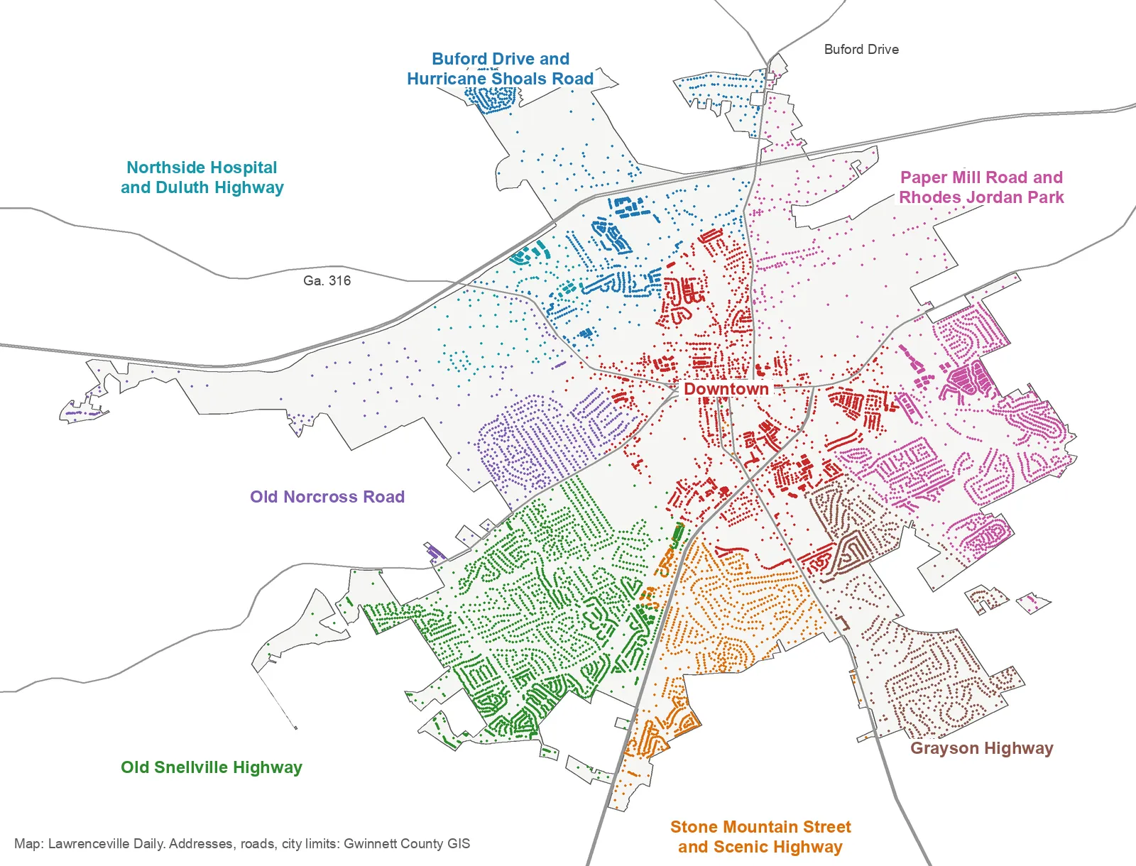
Map by Lawrenceville Daily. Each dot is an address inside city limits in Gwinnett County’s address data, colored by area. City limits and main roads are from Gwinnett County GIS. Areas follow the City of Lawrenceville’s 2045 character area map and the state highways that leave downtown; their edges are approximate.
Downtown and the north
Downtown. The plan’s Downtown character area, “the historical and cultural heart of the city”: the courthouse square, City Hall, the Lawrenceville Lawn and the streets around them. A third of its 3,594 addresses are apartment units.
Buford Drive and Hurricane Shoals Road. North Lawrenceville out past Ga. 316 to Georgia Gwinnett College. The plan says the city’s density is “concentrated around Buford Drive and Hurricane Shoals Road”; half its addresses are apartments. The only area with a sizable Collins Hill High zone.
Northside Hospital area. The plan’s Medical Services Cluster on Duluth Highway around Northside Hospital Gwinnett, mostly apartments.
The west and south
Old Norcross Road. West Lawrenceville between West Pike Street and Lawrenceville Highway: single-family subdivisions, Discovery High and Benefield Elementary, and the city’s only Discovery High zone of any size.
Old Snellville Highway. The city’s largest block of single-family homes, south of downtown, with Central Gwinnett High, Lawrenceville Elementary, Winn Holt Elementary and Alexander Park just past the city line.
Stone Mountain Street. South Lawrenceville between Scenic Highway and Grayson Highway, the plan’s southern cluster of apartments, with the old Female Seminary at its north end.
The east
Grayson Highway. Southeast Lawrenceville behind the plan’s Grayson Highway commercial corridor: houses and duplexes, mostly zoned for Simonton Elementary.
Paper Mill Road and Rhodes Jordan Park. East and northeast Lawrenceville: Rhodes Jordan Park, Jenkins Elementary and Jordan Middle, condos and townhomes along Paper Mill Road, and Briscoe Field.
How we built this
The city does not publish a list of named neighborhoods, and OpenStreetMap’s place names inside the city are individual subdivisions, which we do not use. So the areas come from the City of Lawrenceville’s 2045 Comprehensive Plan, adopted in 2023:
- Downtown and the Northside Hospital area are the plan’s Downtown and Medical Services Cluster character areas, taken from the city’s own character area map.
- The other six are the parts of the city between the state highways that leave downtown, each named for a road or place the plan names: Buford Drive and Hurricane Shoals Road, Old Norcross Road, Stone Mountain Street, Grayson Highway and Paper Mill Road appear in its land use and transportation chapters. Old Snellville Highway is named for the main road through an area the plan does not name.
We placed every address point inside city limits in Gwinnett County’s address data, 14,152 in all, in one area, and matched each to the county’s school zone layer, which the county last updated on Oct. 2, 2026. School scores are the 2025 College and Career Ready Performance Index from the state’s School Grades report; the state average was 78.0 and Gwinnett County Public Schools’ 81.5. Distances are measured on the OpenStreetMap road network. Store and road locations are © OpenStreetMap contributors.
Compare nearby cities
Thinking about Dacula, Snellville or Suwanee instead? Our Lawrenceville vs. Dacula vs. Snellville vs. Suwanee guide sets their tax rates, schools, home values and Census figures side by side. See also moving to Lawrenceville, our schools guide, home prices guide and property tax guide.
Frequently asked questions
What are the neighborhoods in Lawrenceville, Georgia?
This guide splits the city into eight areas drawn from its 2045 Comprehensive Plan: Downtown; Buford Drive and Hurricane Shoals Road; the Northside Hospital area; Old Norcross Road; Old Snellville Highway; Stone Mountain Street; Grayson Highway; and Paper Mill Road and Rhodes Jordan Park.
Is a Lawrenceville mailing address inside the city of Lawrenceville?
Often not. Gwinnett County’s address data lists 108,950 addresses with Lawrenceville as their city name, but only 14,152 of them are inside city limits. Outside the city, Gwinnett County police patrol and the county’s trash program applies.
What high school is Lawrenceville zoned for?
Mostly Central Gwinnett High. In Gwinnett County Public Schools’ zone map, 96% of addresses inside city limits are zoned for Central Gwinnett; small parts are zoned for Collins Hill, Discovery, Mountain View, Grayson and Brookwood.
What ZIP code is Lawrenceville, Georgia?
Inside city limits, almost all of it is 30046: 95% of the city’s addresses in Gwinnett County’s data. The rest are in 30043, 30045 and 30044, which mostly cover unincorporated areas.
What is the typical home value in Lawrenceville?
$376,674 in August 2026 for the city, according to the Zillow Home Value Index, down 2.55% in a year. In ZIP 30046 it was $340,279. It is a modeled typical value, not a sale price.
Have your say